 Home Save Chabot History EBRPD Watch Biotics Contact Us Links Landslide at Site of Proposed Housing (Bench A)
This proposed housing site lies between two branches of the active Hayward Fault . "The Hayward Fault is currently considered by geologists to be the most dangerous in the Bay Area", (Lowney Associates, Geotechnical Investigation; Boulders Residential Development; 1997, page 18). The main branch of the Hayward fault passes horizontally along the near side of the driving range. A secondary branch of the fault crosses the far side of the hill where a "buttress" is proposed to help stabilize slopes that are even steeper than the ones in this picture. This site can expect surface rupture and severe ground shaking in the event of a large magnitude earthquake along the Hayward Fault. This site has landslides now. Imagine what will happen when a large magnitude earthquake strikes.
(Scroll to view larger images)
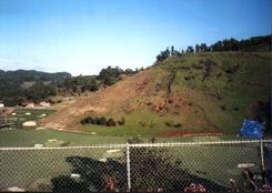
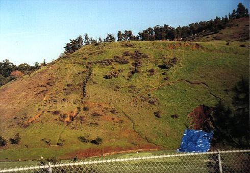
Cracks Appear on Hillside Directly Below Proposed Housing Site January 25, 1998
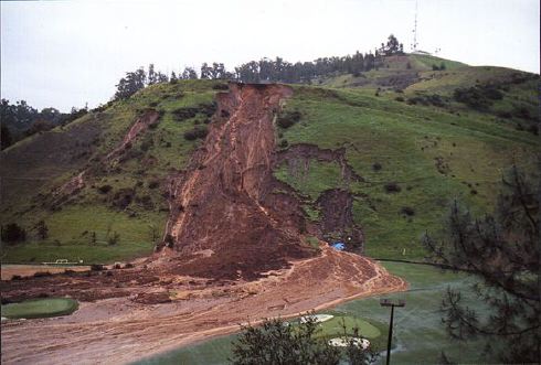
Note the large circular pattern above and to the left of the blue tarp.
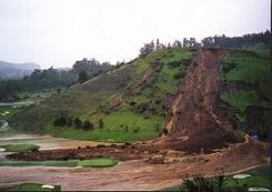
Landslide - February 3, 1998
A local newspaper did a story about this proposed housng project.in which the City of San Leandro Planning Manager was quoted as saying, "They're basically [to be} built on rock, and that's the best soil you can get." (The Daily Review; Hayward, California, November 18, 1997.) We don't agree. If you think this is a bad location to put a housing project, please send a message to San Leandro City Officials and let them know.
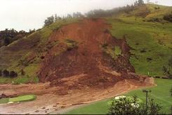
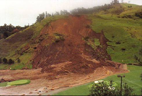
Landslide - February 9, 1998
In this most recent photograph, the landslide has continued to widen to approximately 300 ft. with signs of surface erosion to the left of the main slide area.
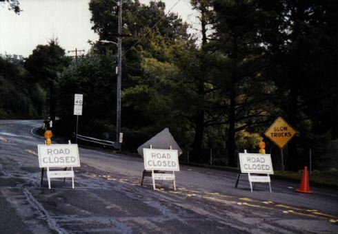
Emergency Access Road Blocked
Lake Chabot Road is the only emergency access and evacuation route for the proposed housing project. Lake Chabot Road was closed on February 3, 1998 due to fallen trees and landslides, including one small landslide at Bench C. This lifeline will also be closed when the Hayward Fault produces surface rupture or seismically induced landslides. According to the EIR, "Fault rupture at the project site would isolate some residence (sic) from the main access road into the subdivision.", (Boulders Residential Development Environmental Impact Report, page 3.4-16).
All photographs by San Leandro Coalition for Responsible Planning
last revised: February 11, 2022 |
|||||||||||||||||||||||||||||||||||||||||||||||||||