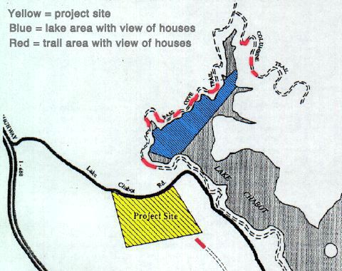
 Home Save Chabot History EBRPD Watch Biotics Contact Us Links View Impact Map of Lake Chabot and Surrounding Trails
The proposed housing project would be visible from Lake Chabot (blue) as well as the Bass Cove Trail and Columbine Trail (red). Although not shown on this map, the proposed project would also be visible along a section of the trail from Estudillo Gate to Chabot Dam. |